At this moment about 75 commercial inland ships are gathering, logging and exporting measured data from the river Rhine (www.covadem.org). During their trips, they simultaneously measure the depth below the ship – i.e. under keel clearance – by using conventional echo sounder equipment and the ship’s location by using GPS. The measured under keel clearances are then translated by NOVIMAR’s partner MARIN into a water depth by correcting for draught, squat and trim. The draught is taken from the logged loading gauge just before the trip starts.
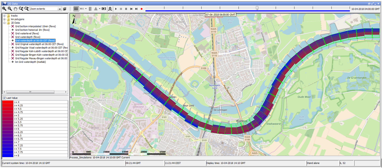
To translate collected depth track data into an actual water depth chart, Deltares has developed an operational CoVadem Delft-FEWS application that handles all the models and data (www.delft-fews.nl). Further a procedure was developed to map the data on a two-dimensional grid covering the river. First, the CoVadem track data is used to construct the riverbed. Second, a hydrodynamic numerical model is used to predict water levels in the river. Finally, the actual and future water depth is obtained by subtracting water level and riverbed level.
An important research aspect is the following. As the sandy riverbed is changing all the time due to the river flow (different morphological processes take place on different timescales) and ship’s track data of one day does not cover the entire width of the river, the data must be combined and processed in such a way that it gives valuable insight in navigation depth without losing measured details.
Finally the attached figure shows a screenshot of the Delft-FEWS application under development. It shows water depths in the river Waal near Nijmegen, the Netherlands. At this time the procedure is validated by using highly detailed multibeam measurements of the riverbed.